Monday 29 October 2012
Sheep
Rose wrote today: "Today was my luckiest day. I received presents from your mum and one of the sheep has given birth! Nicholas reckons by the end of the year they will have doubled. I'll visit them and send photos. Its still raining gumdrops! Give everyone my undying love xxxx".
Just to let you know Nicholas is Rose's brother and looks after our sheep, which we while in Kenya.
Tuesday 23 October 2012
Send A Child To School Scheme
Rose wrote this morning: "SOS !!! Hi everyone. I am appealing to all our friends and well-wishers to come to our rescue. I have no money for the children's food and transport to school. We may be forced to close school earlier than normal."
I have sent some money this morning from our fund-raising "pot".
Club Rafiki are launching a new project - 'Send a Child to School Scheme'. We would like you to sponsor a child - this can be paid monthly, termly or even yearly. Their school fees, transport and food would be covered from this amount.
This is now quite urgent so if you would be interested please contact me: evecoles.kenya@gmail.com
Monday 1 October 2012
Mount Kenya Blog
Harry Minter: Man vs. Mountain
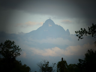
Mount Kenya is the highest mountain in Kenya and the second highest in Africa, after Kilimanjaro. The highest peaks of the
mountain are Batian (5,199 metres (17,057 ft)), Nelion (5,188 metres
(17,021 ft)) and Point Lenana (4,985 metres (16,355 ft)). Mount Kenya is located in central Kenya, just
south of the equator, around 150 kilometres
north-northeast of the capital Nairobi. Mount Kenya is the source of the name of the Republic of Kenya.
Mount Kenya is a stratovolcano created approximately 3 million years
after the opening of the East
African rift. Before glaciation, it was 7,000 m high. It was covered by an ice cap for thousands of years. This has
resulted in very eroded slopes and numerous valleys
radiating from the centre. There are currently 11 small glaciers. The forested slopes are an important
source of water for much of Kenya.
There
are several vegetation bands from the base to the summit. Different
types of forest cover the lower slopes. Many alpine species are endemic to Mount Kenya, such as the giant lobelias and senecios and a local subspecies of rock hyrax. An area of 715 km2
(276 sq mi) around the centre of the mountain was designated a National Park and listed as a UNESCO World Heritage Site in 1997. The park receives
over 16,000 visitors per year.
Day One – 11 km – en route to ‘Old Camp Moses’
After
ensuring that both my bag and belly were fully packed, I set off to Nanyuki
Prep School to meet my guide to escort me up Mount Kenya. Nicholas arrived
around 10 am in a taxi that was to take us on a 45 minute drive to the base of
the mountain and the start of our ascent, and whilst the bags were being loaded
into the car all the children from the school came to wave me off which was
rather nice yet a tad embarrassing.
This part of the walk was relatively easy
and I was able to ask Nicholas about possibly every plant, animal and bird I
saw. About 15 minutes in I stumbled across what I though was a bail of hay but
turned out to be elephant dung! I quickly took a picture and moved on.
My mind
was constantly active today as a vast, dense forest full of activity constantly
surrounded us. At one point I heard monkeys shrieking and was informed that
they we Baboons fighting.
Day Two – 16km – en route to ‘Camp Shipton’
Eventually I reached ‘Shiptons Cave’s’ which were fascinating to look at and marked the start of some real climbing. Reaching the ceiling of these caves was a huge leg burner as most the way up my calves and quads were actually on fire, but with the promise of our camp only 200m vertical I found the determination to keep going at a steady pace. Once at the top of the caves at approximately 4150m above sea level I was able to look back over the 6km valley we had just hiked along which was amazing and gave me a bigger boost to reach the summit.
Subscribe to:
Posts (Atom)


